5 Stunning Mars Panoramas Revealed by NASA's Twin Rovers
NASA's Curiosity and Perseverance rovers have sent back breathtaking panoramic views of Mars, offering a front-row seat to two vastly different landscapes. These sweeping images, captured by the rovers' high-resolution cameras, showcase terrains that were shaped by ancient water and billions of years of geological activity. From the layered slopes of Gale Crater to the delta remnants in Jezero Crater, each panorama tells a unique story of Mars' watery past. In this listicle, we break down the key features of these panoramas and what they reveal about the Red Planet's history.
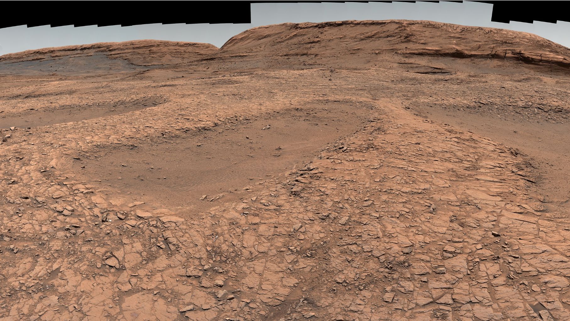
1. Curiosity's View from the 'Gateway to Mount Sharp'
Curiosity's latest panorama was taken from a location nicknamed the Gateway to Mount Sharp, a rocky outcrop on the lower slopes of the 3-mile-high mountain within Gale Crater. The image captures a sweeping vista of eroded buttes and mesas, with the central peak of Mount Sharp rising in the distance. The terrain shows clear evidence of ancient water flows, including cross-bedded sandstones and mudstone layers. Scientists have identified these as remnants of a lake that once filled the crater billions of years ago. The panorama also reveals dark sand dunes at the mountain's base, adding a dramatic contrast to the lighter-toned bedrock.

2. Perseverance's Jezero Crater Delta Panorama
Perseverance's panorama focuses on the western edge of Jezero Crater, where a massive fan-shaped delta of sedimentary rock sits. This delta was formed by an ancient river that carried sediment into a lake. The image shows distinct layers of clay and carbonate minerals, which are key targets for the rover's search for signs of past microbial life. The panorama also includes a view of the crater rim in the distance, with rocky cliffs and boulder fields that hint at the violence of the impact that created the crater. Unlike Curiosity's mountainous view, Perseverance sees a flatter landscape but one rich in fine-grained sediments that could preserve biosignatures.
3. Ancient Water Channels Carved into the Terrain
Both rovers have imaged features that strongly indicate the presence of ancient water on Mars. Curiosity's panorama shows sinuous ridges and inverted channels—remnants of rivers that once flowed across the crater floor. These ridges are formed when the riverbed sediment hardened into rock, while the surrounding softer material eroded away. Perseverance's view includes deeply cut gullies and layered deposits that resemble those formed by flowing water on Earth. The network of channels in Jezero suggests a complex hydrological system, with water entering the crater from multiple directions over millions of years.
4. Billions of Years of Geological Change Exposed
The panoramas also reveal the immense timescale of Martian geology. Curiosity's images show the thick stack of sedimentary layers in Mount Sharp, each representing a different period of deposition and erosion. The lower layers are older, dating back over 3.5 billion years, while the upper layers are more recent. Perseverance sees a similar story in the delta, where the topmost layers are younger than those at the base. Wind erosion has sculpted these rocks into fantastical shapes, including hoodoos and yardangs. The contrasting exposures allow scientists to piece together a timeline of climate shifts, from wet to dry and back again.
5. The Technology Behind the Panoramas
Capturing these sweeping views requires cutting-edge imaging technology. Curiosity uses its Mast Camera (Mastcam) with two color cameras that can take high-resolution images up to 1600x1200 pixels. Perseverance relies on its Mastcam-Z, a more advanced version with zoom capability and stereoscopic imaging. Each panorama is composed of dozens of individual images stitched together. The rovers also use their navigation cameras to provide context, while scientists carefully plan the order of shots to ensure proper lighting and focus. The resulting images are then color-corrected and processed to create the seamless panoramas released to the public.
These panoramas are more than just pretty pictures—they are essential tools for understanding Mars' past. By studying the rock layers, sedimentary structures, and mineral compositions visible in these images, scientists can reconstruct the environmental conditions that existed billions of years ago. The twin rovers continue to explore, sending back new data that refines our knowledge of the Red Planet. As both missions progress, we can expect even more stunning views that will help answer the fundamental question: Was Mars ever home to life?
Related Discussions